Over a span of the last 60 years, advances in technology have remarkably increased the efficiency of the seafood industry. Our fishing boats now have top-notch high-powered engines, GPS, sonar capability, and exceptionally effective fishing gear. This technology has been excellent in some respects and terrible in others. It has allowed us to augment our effectiveness at catching finfish and shellfish, meeting consumer demand and sustaining our fishermen’s livelihoods. On the other hand, it has also made us too efficient and has lent to our tendency to overfish certain species.
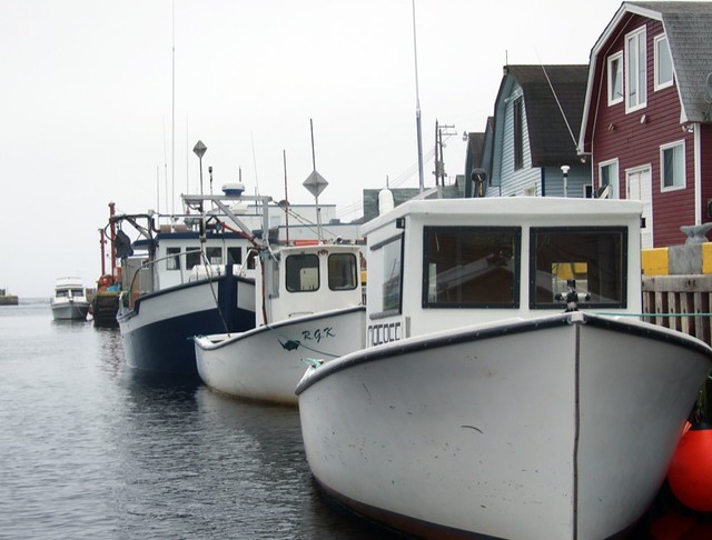
Image courtesy of Flickr user Joseph Novak
Two research institutions in Maine have partnered up and want to use technology from NASA to track movements of certain commercial species, the most important being the Maine lobster. The Gulf of Main Research Institute and the Bigelow Laboratory for Ocean Sciences are vying for a grant that would allow them to develop models for real-time estimates of locations of fish and invertebrates in the Gulf of Maine. The models would use Earth-system data (such as satellites) and reported observations from fishermen and researchers. It sounds like this opportunity would create a fantastic tool for fishermen and researchers; however, as with all new advances in technology, we must be wary that we use it in a way that benefits both us and ocean health.
Adapting to a changing ocean
We have decades, centuries even, of fishing knowledge that help us determine seasons, abundance, and distribution of our favorite seafood species. But our oceans are changing – fishing pressures, other human influences, and natural ocean processes have made landings of some of our commercially valuable species unpredictable. It’s becoming harder to forecast year-to-year variability, and, as a consequence, the fate of many of our fisheries is uncertain. The lobster fishery in Maine witnessed one such strange incident in variability last year. Likely due to warming ocean temperatures in the Gulf of Maine, a flush of soft-shelled lobster was caught too early in the season, driving down prices for fishermen in the market. With a tool to determine the probable timing and volume of lobster landings and what ocean conditions are doing, these fishermen may have been able to avoid the soft-shelled population and focus on a better catch of hard-shell lobsters, keeping preferable market prices.

Image courtesy of Rob Gutro/NASA via Flickr.
At the moment, the plan is to implement this tool only within the Gulf of Maine. Of course, if it proves to be valuable and effective, then researchers and fisheries across the country, and eventually the globe, will see the value of utilizing it. Eventually, we could even have a global system that tracks all pelagic commercial species, giving us continuous information on their whereabouts and abundance. If we had a system like this for multiple fisheries, along with stock assessments and surveys, it would aid scientific data and lend to creating a better overall management system. Regulators could make more informed decisions on catch limits and season lengths, and fishermen would be able to reach their limits more easily and generate a better profit. It sounds incredible – but only if it is used correctly.
Is there a flip side?
Having a tool based on satellite imagery from NASA would certainly be a fantastic instrument for modern fisheries and science. It could also be terribly detrimental for ocean faring creatures. If we can better predict where certain populations of finfish and shellfish are located, and post this data online for all to see, we would be making it that much easier for us to fall into the trap of overfishing. Yes, the ocean has erratic natural conditions, and we are struggling to fully understand how humans are impacting it. But the fact that we cannot always predict where to find our catch may actually be a good thing. If we can pinpoint exactly where these populations are located, it becomes very possible that we could effectively wipe them out without proper management.
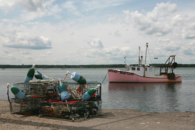
Image courtesy of Flickr user planetlight
We also have to be curious about the accuracy of the technology. The satellite imagery would likely only be able to pinpoint ocean creatures that stick close to the surface or that live in relatively shallow regions. The rest of the model would rely on predicting ocean conditions and visual observations from fishermen and researchers. This conglomeration of data could prove to be imprecise, possibly leading to inaccurate scientific data and regulators making decisions that might harm a population rather than help it. This possibility of new awesome technology is both promising and frightening. It could be an excellent tool for fisheries management and science, leading to healthy and sustainable seafood sources. It could also have negative consequences in the long run for certain species and fisheries. A tool like this one has to be used properly, with effective management, for us to fully realize it’s potential and harness it at the same time. In reality, the future of sustainable fisheries may very well lie in technological innovations such as this one. Help support and sustain healthy oceans by purchasing your wholesale seafood from environmentally friendly distributors such as Pucci Foods.


